2025 Philip's Easy to Read Multiscale Road Atlas of Europe
(A4 paperback with flaps)
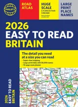
(Author) Philip's MapsPHILIP'S: THE BEST-SELLING EUROPEAN ATLAS RANGE IN THE UK With the detail you need at a size you can read, the latest 2025 Philip's Easy to Read Multiscale Road Atlas of Europe is the ultimate driving companion. Including the rules and regulations across Europe for easy driving, and the high speed network if you need to take to the train. * Super-clear main scale at 1:750,000 (12 miles to 1 inch) * Multiscale mapping with scales from 1:200,000 to 1:3M, showing more detail where you need it * Clear mapping of every country in Europe and the driving rules and regulations * Distance Chart and a 23-page route planning section included, for easy route planning across long distances * Spectacular scenic routes clearly highlighted * Including a handy map of Europe's High-Speed Rail Network to help plan long distance journeys with ease * A4 format with sturdy flaps 'The clearest and most detailed maps of Europe' David Williams MBE, former CEO Gem Motoring Assist 'The best of its kind with quick, easy-to-use information' Fleet Week
Philip's Maps
Philip's Maps is a renowned cartographer known for creating detailed and accurate maps of various regions around the world. Their most notable works include maps of cities, countries, and continents, which are highly regarded for their precision and clarity. Philip's Maps has made significant contributions to the field of geography and navigation through their meticulous attention to detail and dedication to producing high-quality maps. Their work has had a lasting impact on the world of cartography and has become an invaluable resource for travelers, researchers, and historians. One of their most famous works is the World Atlas, which remains a staple in libraries and educational institutions worldwide.
Other related
Philip's RGS World Atlas (A4)
with Global Cities, Facts and Flags

2026 Philip's Big Road Atlas of Britain & Ireland
(A3 Paperback)
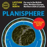
Philip's Planisphere (Latitude 51.5 North)
For use in Britain and Ireland, Northern Europe, Northern USA and Canada