Philip's RGS Essential School Atlas
(Author) Philip's Maps'The best educational book for secondary school kids' - Daily Mirror - The ideal school atlas for Key Stage 3 pupils and Scotland's National Qualifications., 11-14 years old - All updated for 2021-2022 specifically to meet curriculum needs - Specially focused 16-page UK and Ireland section - Comprehensive 62-page world section includes thematic maps on the environment, climate change, people, quality of life, and energy - Published in association with the Royal Geographical Society Philip's RGS Essential School Atlas has been specially created for lower-secondary geography students (11-14 year olds). The maps have been carefully designed to be uncluttered and easy to read, containing specially selected place names and detail. A clear set of symbols and scale information accompanies every map, with a useful introductory section covering basic atlas skills, including aerial photographs and satellite images to further explain particular features on the maps. Latitude and longitude co-ordinates are included in the index, alongside figure-letter references. Fully up-to-date, the atlas includes detailed regional maps, charts and satellite images of Europe, Italy, the Middle East, China, Japan, Kenya, USA, Brazil, and the Arctic and Antarctica. It also focuses on areas of special interest for students of geography, such as Japan's volcanoes and earthquakes, conservation in Kenya, and water supply in the USA. Philip's RGS Essential School Atlas is ideal for special project work and is available in both hardback and paperback editions.
Philip's Maps
Philip's Maps is a renowned cartographer known for creating detailed and accurate maps of various regions around the world. Their most notable works include maps of cities, countries, and continents, which are highly regarded for their precision and clarity. Philip's Maps has made significant contributions to the field of geography and navigation through their meticulous attention to detail and dedication to producing high-quality maps. Their work has had a lasting impact on the world of cartography and has become an invaluable resource for travelers, researchers, and historians. One of their most famous works is the World Atlas, which remains a staple in libraries and educational institutions worldwide.
Other related
Philip's RGS World Atlas (A4)
with Global Cities, Facts and Flags

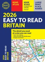
2026 Philip's Big Road Atlas of Britain & Ireland
(A3 Paperback)
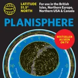
Philip's Planisphere (Latitude 51.5 North)
For use in Britain and Ireland, Northern Europe, Northern USA and Canada